expedia

Trekking in Alay Mountains including Alay Valley

Oleh Alay Travel Guide
Pembatalan percuma tersedia
Harga adalah RM 3,639 seorang dewasa
Ciri-ciri
  • Pembatalan percuma tersedia
  • 7hari
  • Baucar mudah alih
  • Pengesahan serta-merta
  • Pengambilan dari hotel terpilih
  • Berbilang bahasa
Gambaran keseluruhan

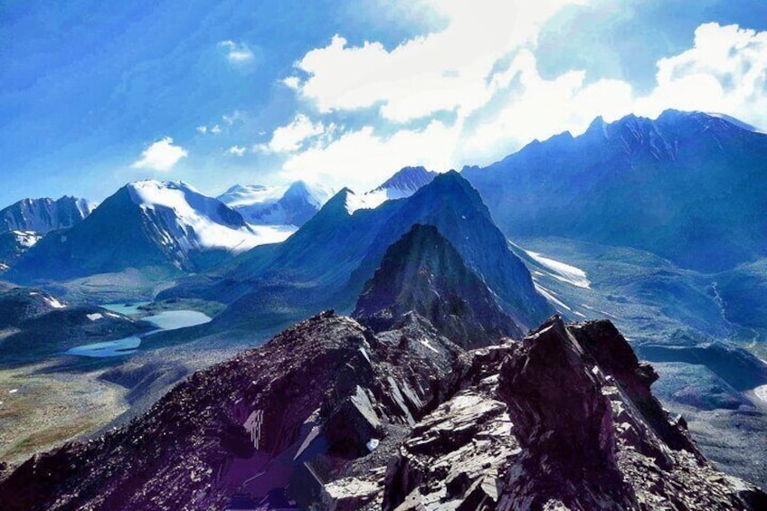
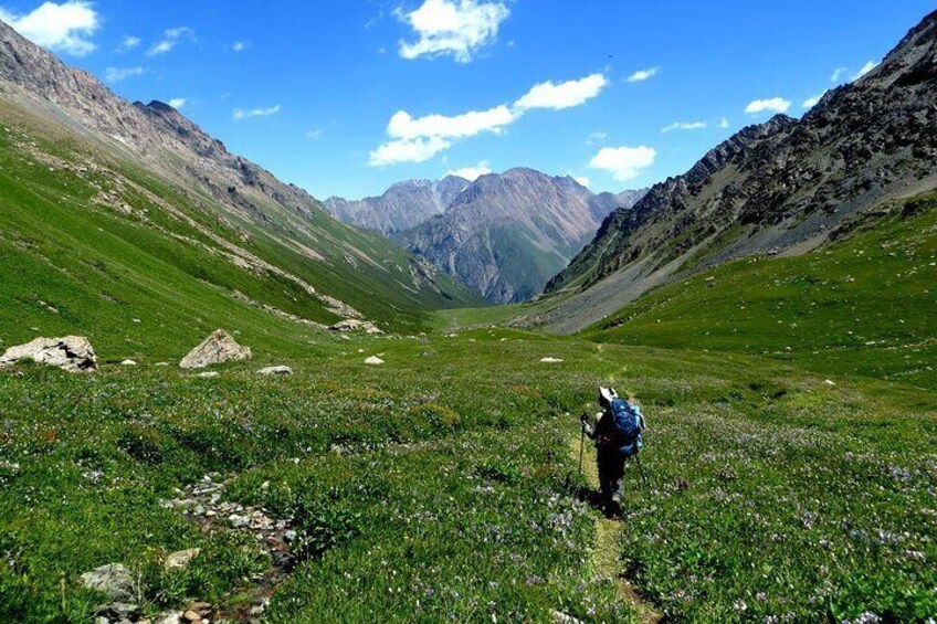
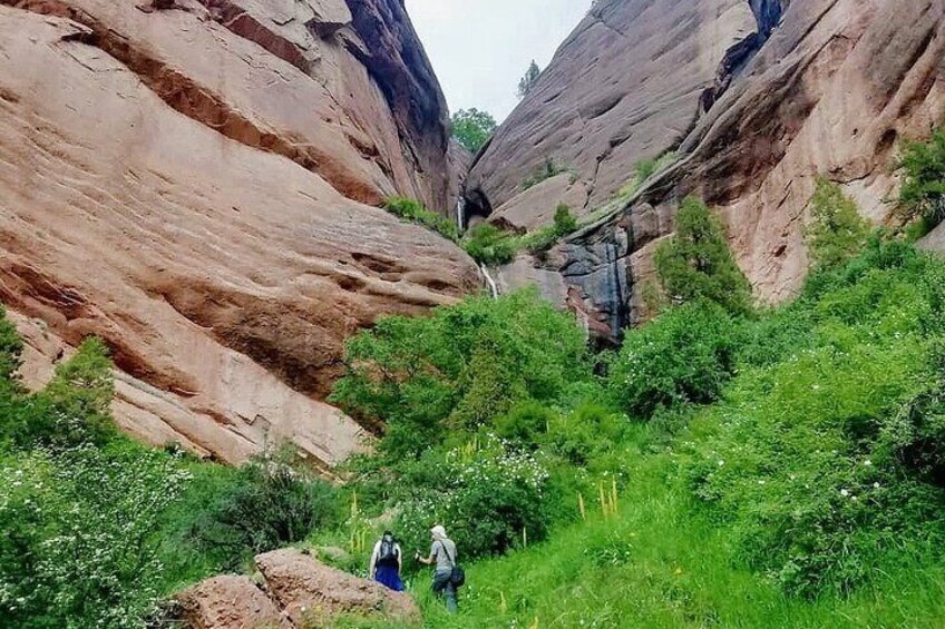
Our trekking tours, developed over many years of practical research and refinement, have become highly popular among European and international nature enthusiasts. These routes are loved by adventurers for their breathtaking landscapes.
In the Alai Valley, the minimum altitude begins at 2,500 meters and quickly rises higher. Due to the altitude, we recommend this hike for people in moderate physical condition. The route includes two challenging passes, Sary-Mogol Pass (4,280 m) and Jiptik Pass (4,185 m), with daily treks of 5–6 hours
Why Start from Tulpar-Kol?
We design our tours with your comfort and safety in mind:

  1. Around Tulpar-Kol, there are several short, hour-long trekking routes without high passes, allowing participants to naturally acclimatize before starting the main trek.
  2. Tulpar-Kol offers reliable connections and internet access, which is vital for safety. If anyone feels unwell or experiences mountain sickness, immediate transport by car is available.

Lokasi aktiviti

  • Lake Tulpar-Kol
    • Sary Mogul, Kyrgyzstan

Titik Pertemuan/Penebusan

  • Alay travel house
    • Sary Mogul, Osh Region, Kyrgyzstan

Semak ketersediaan


Trekking in Alay mountains including Alay valley
  • Tempoh aktiviti ialah 7 hari7hari
    7hari
  • Bahasa Inggeris

Pickup included

Masa bermula: 08:00
Butiran harga
RM 3,638.66 x 1 DewasaRM 3,638.66

Jumlah
Harga adalah RM 3,638.66

Perkara yang dirangkumi dan tidak dirangkumi

  • Apa yang disertakanApa yang disertakanTransport from Osh to Sary-Mogol and internal transfers as in program
  • Apa yang disertakanApa yang disertakan7 nights with meals (guesthouses, yurt cams) in Trekking
  • Apa yang disertakanApa yang disertakanEnglish-Speaking trekking guide
  • Apa yang tidak disertakanApa yang tidak disertakanAccommodations in Osh
  • Apa yang tidak disertakanApa yang tidak disertakanTransport for the return way to Osh (because travelers can choose options of further trip)
  • Apa yang tidak disertakanApa yang tidak disertakanPorter for heavy things If need, it is extra charge, Travellers can leave stuff in Sary-Mogol
  • Apa yang tidak disertakanApa yang tidak disertakanTip money for service providers
  • Apa yang tidak disertakanApa yang tidak disertakanAdditional services in addition to standard programs

Ketahui sebelum anda tempah

  • Service animals allowed
  • Public transportation options are available nearby
  • Not recommended for travelers with spinal injuries
  • Not recommended for pregnant travelers
  • Not recommended for travelers with poor cardiovascular health
  • Travelers should have at least a moderate level of physical fitness
  • The first 3 days are accessible to all categories of people and cars, when the trek starts there are no car road. When tourists are at Tulpar-Kol if after 2 days they have good acclimatization then they can continue trekking if not then they can go back to Osh or along other routes
  • not recommended for travelers with altitude issues

Jadual perjalanan aktiviti

Hari 1: Start from Osh though Sary-Mogol-Tulpar Kol lake
  • 1 hentian
  • Hidangan: sarapan, makan tengah hari, snek
  • Penginapan: Yurt camp (twin and shared beds) with heating and light
Lake Tulpar-Kol
  • 5j
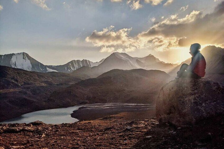
Departure from Osh, on the way visit the lake Kolduk, walk around the lakes for 1 h then continue driving to Sary-Mogol, lunch in Alay travel house then, driving(1h) to Tulpar kol yurt camp. Afternoon walk around the lakes. Tulpar-Kol, known for its picturesque yurt camps, is an incredible destination for all types of travelers, whether active hikers or those looking for a more relaxed experience. Guests can stay in traditional yurts and enjoy activities such as hiking, horseback riding, and multi-day trekking options Accommodation: yurt camp (twin and share beds in yurts are available) outside share solar water heater shower, water running toilets, Connection: there is solar electricity for phone charge and signal (megacom, beeline, O) and Wi-Fi in 5G Driving distance: 245km /152miles Time of reaching: 5hours (excluding break and lunch times) Highest and lowest points: 3610/980 meters Accommodation altitude: 3500.00 Meters | 11482.94 Feet Tour category: easy
Hari 2: Walk to traveler’s pass 4130m then come back to Tulpar-Kol
  • 1 hentian
  • Hidangan: sarapan, makan tengah hari, snek
  • Penginapan: Yurt camp (twin, single and shared beds) with heating and light all blankets are provided (sofa, mattress...)
Lenin Peak
  • 6j
Leave the heavy bags in yurt, walk to the traveler’s pass through the Base Camp enjoy the panoramic view of Lenin Peak, lunch then come back to the yurt with same route. Overnight in same yurt. Daily route: Tulpar-Kol to Travelers' Pass-Tulpar-Kol Distance: ~14 km round trip Duration: 3-7 hours Difficulty: Moderate to challenging (where is walking up to Travel Pass) Ascent/Descent: 650/50 Highest and lowest points: 4127/3500 Description: This trail takes you through alpine meadows and ascends to the Travelers' Pass (~4,130 m), offering breathtaking views of the whole view of Lenin Peak and the Alay Valley below. The high altitude and steep sections make this hike more challenging but rewarding. if you don't want to go all the way to the pass then you will have the opportunity to get to the base camp (there and back 6 km 3 hours)
Hari 3: Tulpar Kol- through Tuyuk canyon to Sary-Mogol
  • 1 hentian
  • Hidangan: sarapan, makan tengah hari, snek
  • Penginapan: Alay travel house (twin, single, double)
Sary Mogul
  • 5j
The route from Tulpar-Kol Lake to Tuyuk Canyon is a hidden gem for trekkers in the Alay Valley. This trail not only offers solitude and pristine landscapes but also provides some of the best views of Peak Estonia (6,202 m) and Peak Latvia (6,134 m), two impressive peaks in the Zaalaysky Range. Trail to Tuyuk Canyon: There are two options through Peak panorama (4hours up and down-moderate level) and along the lakeside with a road (2hours- easy hiking) Total distance: 31km Driving distance: 22km 40min Hiking distance and time: 9km, 3-4 hours (excluding lunch and break time) Ascent/Descent: 130/450 meters Highest and lowest points: 3500/2920 meters Accommodation altitude: 2976.00 Meters | 9763.78 Feet Night in guesthouse (Alay travel house) The rooms are available for family, twin and single with hot showers and water running toilets Dinner will be prepared by cooking team of guesthouse. Connection: there is electricity, internet (Wi-Fi) and signal
Hari 4: Sary-Mogol via Sary-Mogol pass to yurt camp
  • 1 hentian
  • Hidangan: sarapan, makan tengah hari, snek
  • Penginapan: local families nestled yurts for overnight stays (shared beds on carpet floor) with flash toilet
Alay Mountains
  • 6j
Today we continue our trekking in north range of Allay valley (Trans-Alay). From Sary-Mogol to trailhead we go by car (1h) then trekking starts it is going to be bit taught trek because we go up to the pass called Sary-Mogol pass (4270 meters) and Besh-Kol lake. Our daily route takes for 6-8 hours of walking up in rocky path. At the top of the pass we enjoy the stunning scenery of Besh-Kol lakes. Then keeping the way to other side until the yurt camp. Total distance 31km Driving distance: 17km (1hour by car) Trekking distance: 14km, 8.70 miles Time of hiking: 6hours (excluding driving, break and lunch) Ascent/Descent: 910/790 meters Highest and lowest points: 4270/3380 meters Accommodation altitude: 3458.00 Meters | 11345.14 Feet Accommodation: yurt stay with shared beds on the carpet, there are blankets, water running toilet. Connection: No electricity, internet and signal Food: lunch-box on the route and dinner in yurt camps Host: name of woman is Orozgul
Hari 5: Walking to Koshmoinok
  • 1 hentian
  • Hidangan: sarapan, makan tengah hari, snek
  • Penginapan: Yurt camp with solar (water) heater shower and water running toilet. There 2 share yurts and a hut for eating.
Alay Mountains
  • 7j
Head east following the river and slightly descending to the end of the beautiful mountain gorge. Enjoy grandiose views of the Kichik Alay or Trans Alay mountain range, at first we cross a small village under Sary-Mogol further direction of travel turns to the right on the dirty auto road after 2-3 hour we reach a small village Kyzyl-Chara and stop here for lunch in home stay or at a cafes on the way, then forward go on to yurt camp in Koshmoinok. Approximate trekking distance: 18km (11.18miles) Hiking time: 7h (excluding lunch and break time) Ascent/Descent: 830/1460 Highest and lowest points: 3467 /2467m Accommodation altitude 2822.00 Meters | 9258.53 Feet Accommodation: yurt stay (shared beds on ground with carpet and blankets) there are solar water heater shower and flash toilet. Connection: No electricity, internet and signal Food: lunch on the route and dinner will be cooked by hosts in yurt Host: The name of owner is Nurdoolot and Begali.
Hari 6: Koshmoinok - Kozho-Kelen village, then transfer to Jiptic yurt camp
  • 1 hentian
  • Hidangan: sarapan, makan tengah hari, snek
  • Penginapan: Yurt camp (2 beds if many people it will be share beds, there isa carpet on the ground and blankets are enough)
Alay Mountains
  • 6j
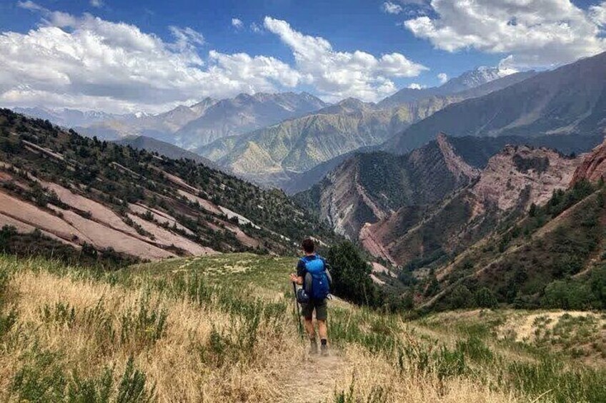
We will begin next day of the trek on the slopes of the beautiful Cretaceous mountains of Kichik-Alay, straightaway we cross the pass of Sary-Bel (3150m) stunning rocks, amazing view of natural creation After descending to Kojo-Kelen, we’ll take a short break at a local home to enjoy a refreshing shower and tea, providing a chance to relax and recharge. Following this, our local driver will transfer (because of long way) you to a yurt camp located near the base of Jiptik Pass—offering a well-explored and thoughtfully planned option for your journey. Accommodation: yurt (share beds) there is simple and flash toilet. Connection: No electricity, internet and signal Meals: lunch on the way and dinner will be cooked by owners in yurt Total distance: 25km (15.53 miles) Hiking distance and time: 10km (5 hours walking +1 hour driving excluding lunch and break time) Ascent/Descent: 1400/980 Highest and lowest points: 3300 /2220m Accommodation altitude: 3250.00 Meters | 10662.73 Feet
Hari 7: Jiptik yurt camp to Sary-Mogol
  • 1 hentian
  • Hidangan: sarapan, makan tengah hari, snek
  • Penginapan: Alay Travel house (twin, single and double beds)
Alay Mountains
  • 5j
After breakfast, the trek continued up to the top of the pass "Jiptik" and cross it until noon (4185 asl). If the sky is clear from the pass you can see a stunning view of the Pamir-Alay valley with Lenin Peak (7134). On the top you will have your lunch and photo shooting. After soaking in the stunning scenery, descend towards Darbaza-Tash traversing picturesque landscapes. Upon reaching Darbaza-Tash, a transfer will take you to Sary-Mogol Accommodation: Guesthouse (Alay travel house). The rooms has double, twin and single beds with hot showers and water running toilets Total distance: 26km Trekking distance: 15 km (15.53 miles) Driving distance: 11km (40min driving) Hiking time: 5h walking then 30 min driving (excluding lunch and break time) Ascent/Descent: 910/1240 meters Highest and lowest points: 4170 /3215 meters Accommodation altitude: 2976.00 Meters | 9763.78 Feet

Lokasi

Lokasi aktiviti

  • LOB_ACTIVITIESLOB_ACTIVITIESLake Tulpar-Kol
    • Sary Mogul, Kyrgyzstan

Titik Pertemuan/Penebusan

  • PEOPLEPEOPLEAlay travel house
    • Sary Mogul, Osh Region, Kyrgyzstan

Tawaran Terbaik untuk Aktiviti Menarik

Alami keajaiban dunia dengan lebih dekat dengan tawaran hebat untuk aktiviti menarik sama ada dekat atau jauh. Expedia menawarkan aktiviti unik yang membolehkan anda menerokai Sary Mogul dengan cara tersendiri. Sama ada anda menyukai alam semula jadi, budaya, makanan atau pengembaraan, kami mempunyai aktiviti yang sempurna untuk anda.

Pengalaman Popular di Sary Mogul

Dengan begitu banyak aktiviti menarik di Sary Mogul, merancang hari untuk keluar mungkin menjadi satu cabaran. Expedia di sini untuk memudahkan pencarian tarikan, lawatan dan aktiviti terbaik di Sary Mogul. Keluarga, pasangan dan pengembara perniagaan semuanya dapat mencari aktiviti yang sempurna di Sary Mogul untuk mencipta kenangan indah dengan bantuan Expedia.