expedia

Pamir Highway through Wakhan Corridor

Oleh Alay Travel Guide
Pembatalan percuma tersedia
Harga adalah RM 9,138 seorang pengembara* *Dapatkan harga yang lebih rendah dengan memilih lebih daripada 2 orang dewasa
Ciri-ciri
  • Pembatalan percuma tersedia
  • 7hari
  • Baucar mudah alih
  • Pengesahan serta-merta
  • Pengambilan dari hotel terpilih
Gambaran keseluruhan

Pamir Highway Tours: An Adventure Through the Roof of the World
Embark on an unforgettable journey along the legendary Pamir Highway, one of the world’s most iconic and remote road trips. Known locally as the M41, this breathtaking route spans rugged landscapes, high-altitude passes, and vibrant cultures, weaving its way through the heart of Central Asia.

Our Pamir Highway tours take you from the green valleys of southern Kyrgyzstan through the dramatic peaks of the Pamirs, exploring ancient Silk Road towns, pristine alpine lakes, and traditional mountain villages. Experience the unique hospitality of the Pamiri people, visit historic caravanserais, and witness awe-inspiring views that stretch into the heavens.

Whether you're a cyclist seeking a thrilling challenge, a motorbike enthusiast craving adventure, or a road trip lover eager to explore the “Roof of the World,” our expertly curated tours offer something for everyone.

Lokasi aktiviti

  • Lake Tulpar-Kol
    • Sary Mogul, Kyrgyzstan

Titik Pertemuan/Penebusan

  • Lake Tulpar-Kol
    • Sary Mogul, Kyrgyzstan

Semak ketersediaan


Pamir Highway through Wakhan Corridor
  • Tempoh aktiviti ialah 7 hari7hari
    7hari

Pickup included

Masa bermula: 09:00
Butiran harga
RM 9,137.50 x 1 PengembaraRM 9,137.50

Jumlah
Harga adalah RM 9,137.50
Hingga Isn, 14 Jul

Perkara yang dirangkumi dan tidak dirangkumi

  • Apa yang disertakanApa yang disertakanDriver's fee and accommodation with meals
  • Apa yang disertakanApa yang disertakan4WD (transport) with fuel
  • Apa yang tidak disertakanApa yang tidak disertakanYour accommodation and meals in the program
  • Apa yang tidak disertakanApa yang tidak disertakanVisa and permit GBO
  • Apa yang tidak disertakanApa yang tidak disertakanNotification to the Department of Tourism of the Kyrgyz Republic

Ketahui sebelum anda tempah

  • Service animals allowed
  • Public transportation options are available nearby
  • Not recommended for travelers with spinal injuries
  • Not recommended for pregnant travelers
  • Not recommended for travelers with poor cardiovascular health
  • Travelers should have at least a moderate level of physical fitness

Jadual perjalanan aktiviti

Hari 1: Start from Osh (airport, border or hotel) to Tulpar Kol lake
  • 1 hentian
  • Hidangan: Tidak termasuk
  • Penginapan: Tidak termasuk
Lake Tulpar-Kol
  • 5j
Total time: 6 hours Driving distance: 245km (152 miles) Max Elevation: 3640 m (Taldyk Pass) Min Elevation: 1000m (Osh) Overnight altitude: 3500.00 Meters | 11482.94 Feet (Tulpar-Kol) Tour category: easy Communication: there is a signal (megacom, beeline and O) + there is Wi-Fi (5G). Accommodation type: yurt camp (2 beds and 4 beds in yurts) The road ascends gradually, revealing views of lush green valleys, distant mountains and small Kyrgyz villages. As you approach Sary-Tash, Sary-Mogol you will begin to see snow-capped peaks, including parts of the Pamir range and stunning views of the Alay Valley with Lenin Peak 7134m in the background. After arriving in Tulpar-Kol, you can see incredible landscapes of about 50 lakes among the hills, untouched nature and wild landscapes. the driver will take you directly to the yurt where you can have lunch. Afterwards, enjoy a walk through the surrounding area until sunset, admiring the best views of Lenin Peak.
Hari 2: Tour Route: Tulpar-Kol Yurt Camp to Murghab (Tajikistan)
  • 1 hentian
  • Hidangan: Tidak termasuk
  • Penginapan: Tidak termasuk
Murghab
  • 8j
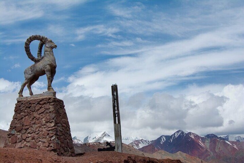
Today, we embark on an unforgettable journey into the breathtaking landscapes of Tajikistan via the famous M41 Highway. The route from Tulpar-Kol Yurt Camp to Murghab is a full-day adventure, largely due to the challenging road conditions. The road traverses some of the highest mountain passes in the region, including Kyzyl-Art Pass (4,280 m) and Ak-Baital Pass (4,655 m), offering spectacular views of rugged terrain and pristine valleys. Along the way, we will stop at picturesque spots, perfect for rest breaks and capturing stunning photos of the surrounding mountains. Arrival in Myrgab Total time: 9 hours Driving distance: 280km (174 miles) Max Elevation: 4655 meters (Ak-Baital Pass) Min Elevation: 2980 m (Sary-Mogol) Overnight at 3611.00 Meters | 11847.11 Feet (Murgab) Tour difficulty: easy Communication: There is a signal (Tcell, Megafon and Beeline) we recommend taking Tcell for all regions of Tajikistan is better Accommodation type: guesthouse (2 beds and 4 beds)
Hari 3: Murgab-Bulunkul –langar
  • 2 hentian
  • Hidangan: Tidak termasuk
  • Penginapan: Tidak termasuk
Wakhan Corridor
  • 8j
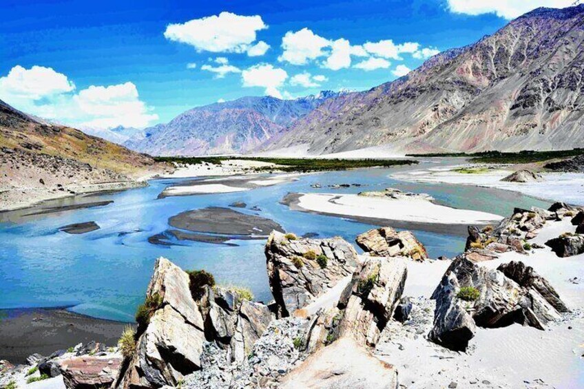
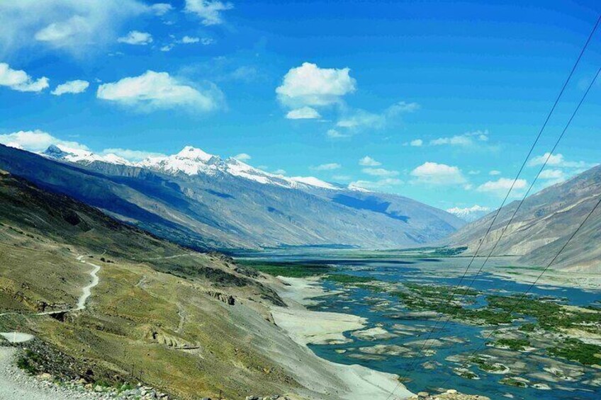
We begin the day with an early morning departure from Murghab, heading toward the beautiful Alichur Valley. After a 3-hour drive (150 km), we arrive at the serene Yashilkul and Bulunkul lakes, situated at an altitude of 3,914 meters (12,841 feet). At Yashilkul Lake, the larger of the two, enjoy a short hike to explore the area and take in its pristine beauty. Afterward, we continue our journey, driving approximately 120 km along the iconic Wakhan Valley of the Pamir Highway. This stretch of the route offers breathtaking views of rugged landscapes, towering peaks, and lush valleys. Our destination for the night is the village of Langar Total time: 8 hours Driving distance: 270km (167 miles) Max Elevation: 4315 meters (Khargush Pass) Min Elevation: 2850 m (Langar) Overnight at 2850 meters | 9347 feet Tour difficulty: moderate Communication in Langar: There is a signal (Tcell) Accommodation type: guesthouse
Wakhan
  • 8j
Hiking option in Lanagr: Walk at will This day (day4) is possible to take a walk, having informed the driver in advance. If you want to hike to the high points of the Pamirs, a one-day hike from Langar Village to a good viewpoint of Engels Peak (6,510 m) is recommended. The hike will take a whole day, covering a total distance of 18 km (round trip) from the house. When you will reach a small pond at an altitude of 3,950 m, you should stop to enjoy the view of the peak from afar. After taking in the scenery, return along the same path to the village. Approximate trekking distance: 18km, 11 miles Time of hiking: 8hours, excluding lunch and break Ascent/Descent: 1160/40 meters Highest and lowest points: 3960/2850 meters
Hari 4: Langar to Ishkashim (125km 2h, 4-5 hours exploring)
  • 1 hentian
  • Hidangan: Tidak termasuk
  • Penginapan: Tidak termasuk
Eshkashem
  • 6j
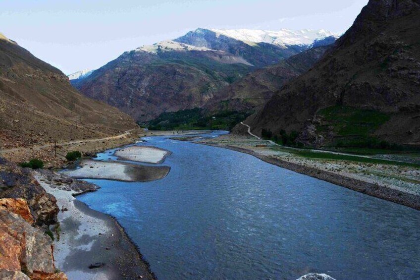
The most interesting and enjoyable point of the Wakhan corridor is located along this route. The following attractions you will see and pass. Panj River Views: The road runs parallel to the Panj River, offering glimpses of Afghan villages, terraced fields, and rugged mountain scenery. Traditional Pamiri Villages: Along the way, several villages where you can see traditional Pamiri houses  · Yamchun Fortress: A striking ancient fortress perched on a hill overlooking the Wakhan Valley. It is believed to date back to the Kushan Empire and offers incredible views of the surrounding mountains. · Bibi Fatima Hot Springs: A natural hot spring revered for its healing properties and provided with facilities for relaxing bathing. After the soaking trip arrive to Ishkoshim Overnight at 2526.00 Meters | 8287.40 Feet (Ishkashim) Communication: There is a signal (Tcell) Accommodation type: guesthouse
Hari 5: Ishkashim to Khorog (120km 5 hours exploring)
  • 2 hentian
  • Hidangan: Tidak termasuk
  • Penginapan: Tidak termasuk
Khorog
  • 6j
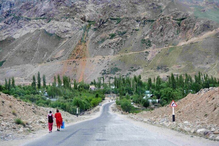
Kozide and Rushan: Charming villages with traditional Pamiri houses. These are great places to stop and observe the unique mountain wildlife and vibrant seasonal flowers along the way. Scenic drive: The road follows the Panj River, which forms the natural border between Tajikistan and Afghanistan. See Afghan villages, suspension bridges and steep terraced fields on the far side. Before entering Khorog, one of the best mineral hot springs is Garm Chashma. Known for its mineral-rich waters, which are believed to have healing properties. Facilities for a relaxing bath. Arrival in Khorog The capital of Gorno-Badakhshan Autonomous Region and a hub for travelers exploring the Pamirs. Highlights: Khorog Botanical Garden: One of the highest botanical gardens in the world, offering stunning views of the city and mountains. Regional Museum: A great place to learn about Pamiri culture and history. Relax and enjoy local dishes by the Gunt River and hand-made souvenir shops amaze with their beauty
Bartang
  • 6j
If you want to include more hiking during your trip, we recommend visiting one of the unique rocky settlements of the Tajik villages, known as Jizev (also called Jizeu). This remote village, located entirely under a rock, has no communication services or electricity, offering a rare glimpse into a purely traditional and ecological way of life. To reach Jizev, you will need to drive 85 km from Khorog to a bridge where your hike begins. The trek is approximately 6 km (one-way) and leads you through a stunning gorge. As you approach the village, you'll discover simple clay and stone houses surrounded by breathtaking natural beauty. Spending the night here is your purely ecological overnight stay. Driving the trekking point: 85km (52miles) from Khorog Approximate trekking distance from the bridge: 6km, 4 miles (one side) Time of hiking: 2-4 hours, excluding lunch and break Ascent/Descent: 420/10 meters Highest and lowest points: 2487/2075 meters
Hari 6: Khorog-Khalaikhum
  • 1 hentian
  • Hidangan: Tidak termasuk
  • Penginapan: Tidak termasuk
Kalaikhum
  • 7j
If you choose not to visit Jizev, our route will continue from Khorog to Khalaikum. Along the way, you will be amazed by the sight of real mountaineers and Tajik families living on the slopes of the mountains and the Panj River offers constant views of Afghanistan. Suspension bridges and narrow footpaths used by Afghan locals provide excellent photo opportunities. Occasional sightings of Afghan caravans or traders on the other side. Due to bad condition road it's a long drive from Khorog to Kalaikhum. Driving distance: 248km (154 miles) Total time: 7 hours (excluding entertainment time) highest point: 2150 meters (Khorog) Lowest point: 1260 m (Khalaikhum) Ascent and descent: 4000 and 4830 meters Overnight at 1260.00 Meters | 4133.86 Feet (Khalaikhum) Tour difficulty: moderate Communication: There is a signal (Tcell, Megafon and Beeline) Accommodation type: guesthouse or hotel
Hari 7: Khalaikhum to Dushanbe (capital of Tajikistan) through Nurek reservoir
  • 1 hentian
  • Hidangan: Tidak termasuk
  • Penginapan: Tidak termasuk
Dushanbe
  • 7j
You will travel along the natural border - the Pyanj River and along the border with Afghanistan. This part will amaze you with its unique mountains. Dushanbe is the capital and largest city of Tajikistan. Dushanbe means Monday in the Tajik language. It was named so because it grew out of a village that originally had a popular market on Mondays. In Dushanbe, there are 802 700 people (2016). Height above sea level: 706 m (2,316 feet) Climate: In summer, it is hot and dry, and winters are cold, but not very cold. On reaching Dushanbe, drive to hotel stay here. End of tour-service Driving distance: 350km (217miles) Total time: 6 hours (excluding entertainment time) highest point: 2030 meters Lowest point: 466 m (Mehrobot) Ascent and descent: 5220 and 5700 meters Overnight Altitude: at 700 meters / 2,297 feet (Dushnabe) Tour difficulty: moderate Communication: There is a signal (Tcell, Megafon and Beeline) Accommodation type: guesthouse or hotel

Lokasi

Lokasi aktiviti

  • LOB_ACTIVITIESLOB_ACTIVITIESLake Tulpar-Kol
    • Sary Mogul, Kyrgyzstan

Titik Pertemuan/Penebusan

  • PEOPLEPEOPLELake Tulpar-Kol
    • Sary Mogul, Kyrgyzstan

Tawaran Terbaik untuk Aktiviti Menarik

Alami keajaiban dunia dengan lebih dekat dengan tawaran hebat untuk aktiviti menarik sama ada dekat atau jauh. Expedia menawarkan aktiviti unik yang membolehkan anda menerokai Sary Mogul dengan cara tersendiri. Sama ada anda menyukai alam semula jadi, budaya, makanan atau pengembaraan, kami mempunyai aktiviti yang sempurna untuk anda.

Pengalaman Popular di Sary Mogul

Dengan begitu banyak aktiviti menarik di Sary Mogul, merancang hari untuk keluar mungkin menjadi satu cabaran. Expedia di sini untuk memudahkan pencarian tarikan, lawatan dan aktiviti terbaik di Sary Mogul. Keluarga, pasangan dan pengembara perniagaan semuanya dapat mencari aktiviti yang sempurna di Sary Mogul untuk mencipta kenangan indah dengan bantuan Expedia.