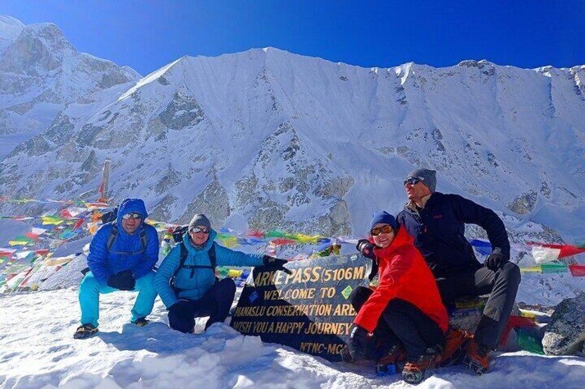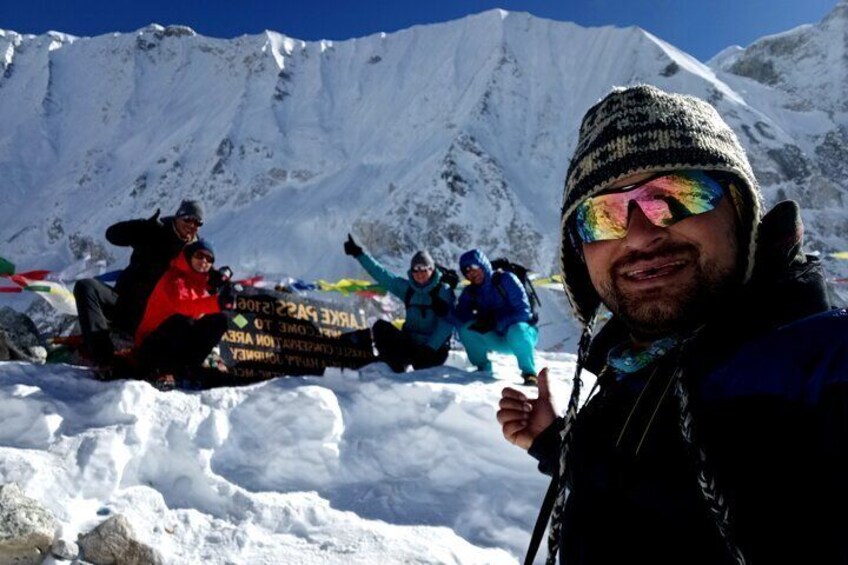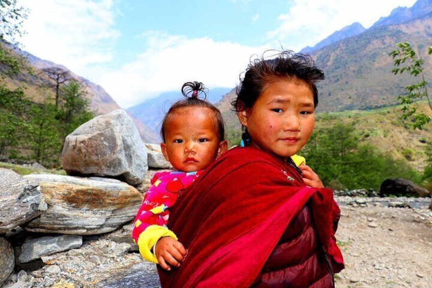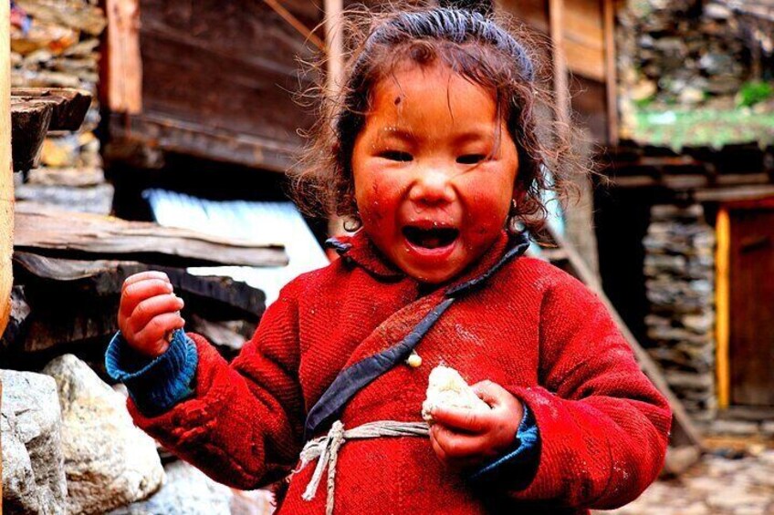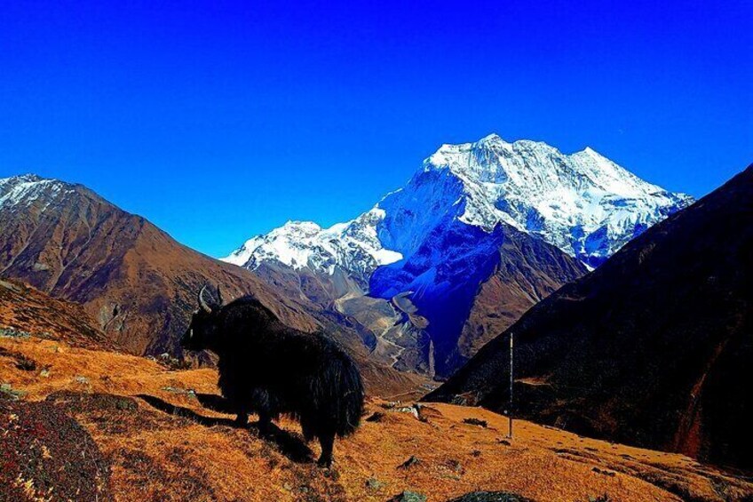

Considered by many guides to be the best all-around trek in Nepal, the Manaslu Circuit Trek leads adventurers around Mt. Manaslu (8156 meters/26,758 feet) – the 8th highest mountain in the world. Enjoy a mix of everything on the Manaslu Trek. In the beginning, charming Gurung settlements and dense forests line the trail. Climbing and carving along the steep walls of the Budhi Gandaki River, you arrive at Manaslu Base Camp. Still, the best has yet to come. Reach Larke La Pass (5135m), where you can’t hear a thing but the wind and a staggering wall of Himalayan peaks surround you. If you are looking for a secluded trek in the heart of the Himalayas, full of cultural wonder and unique natural beauty, the Manaslu Circuit Trek is perfect for you. The Manaslu Circuit Trek will have you planning your next trip to the Himalayas in no time.
Lokasi aktiviti
Soti Khola
Gorkha, Gandaki Province, Nepal
Titik Pertemuan/Penebusan
Soti Khola
Gorkha, Gandaki Province, Nepal
Semak ketersediaan
Manaslu Circuit Trek
Tempoh aktiviti ialah 13 hari13hari
13hari
Bahasa Inggeris
Pickup included
Pilihan bahasa: Bahasa Inggeris
Butiran harga
RM 6,117.00 x 1 DewasaRM 6,117.00
Jumlah
Harga adalah RM 6,117.00RM 6,117.00
termasuk cukai & fi
Hingga Kha, 16 Jul
Memuatkan
Perkara yang dirangkumi dan tidak dirangkumi
Apa yang disertakanApa yang disertakan
Private transportation
Apa yang tidak disertakanApa yang tidak disertakan
International Airfair
Apa yang tidak disertakanApa yang tidak disertakan
Personal Insurance
Ketahui sebelum anda tempah
Not recommended for travelers with spinal injuries
Not recommended for pregnant travelers
Not recommended for travelers with poor cardiovascular health
Travelers should have at least a moderate level of physical fitness
We accommodate meals according to your needs if you are vegetarian, or any dietary needs.
Jadual perjalanan aktiviti
Hari 1: Drive from Kathmandu to Arughat (570m) and further drive to Sotikhola, 8-9 hour drive.
1 hentian
Hidangan: sarapan, makan tengah hari, snek
Penginapan: Overnight at a local guesthouse.
Soti Khola (Sambil lalu)
We set off early today toSotiKhola. During the drive, we have views of the countryside, with glimpses into the locals’ lifestyle and surrounding mountain sceneries. We drive on a smooth road from Kathmandu to DhadingBesi, the district headquarters of Dhading (1050m) but the drive from DhadingBesi to Arughat will be on a rough road. Upon reaching Arughat, a major town in the region, we drive further towards SotiKhola.
Hari 2: Trek from Sotikhola to Machhakhola (930m), 5-6 hours.
1 hentian
Hidangan: sarapan, makan tengah hari, snek
Penginapan: Overnight at a local gesthouse.
Lapubesi (Sambil lalu)
Aftercross the first bridge, we trek through the beautiful Sal forests, then climb onto a ridge above the flowing rapids of the BudhiGandaki. We then reach Khursanewhere the rough trail ascends and descends past two cascading waterfalls on a steep trail clinging to the side of a cliff. We eventually head down, passingterraced rice fields, then up and around to the Gurung village of Labubesi. We further climb behind a rocky outcropping, where the valley opens up. Dropping to the sandy river bed, we walk on the stones before climbing over another ridge. We head down again to the river and cross another suspension bridge to reach MachhaKhola village.
Hari 3: Trek from Machhakhola to Jagat (1370m), 5-6 hours.
1 hentian
Hidangan: sarapan, makan tengah hari, snek
Penginapan: Overnight at a local Guest House.
Jagat (Sambil lalu)
Our narrow trail makes a few small ups and downs and eventually traverses over the TharoKhola to reach Khorlabesi. After a few more ups and downs, we come across a small natural hot spring in Tatopani. From the hot spring, we move over another ridge, and cross the BudhiGandaki on a suspension bridge. At this juncture, we climb on a wide, well-crafted staircase, then across a landslide and over a ridge to Doban. After we cross the suspension bridge over the YaruKhola, we climb the stone stairs and descend to the river. We again climb more stone stairs to TharoBharyang. Crossing the west bank of the BudhiGandaki, we climb over another ridge and walk along the river to eventually reach the village of Jagat.
Hari 4: Trek from Jagat to Deng (1920m), 6-7 hours.
1 hentian
Hidangan: sarapan, makan tengah hari, snek
Penginapan: Overnight at a local Guest House.
Nepal (Sambil lalu)
After breakfast, our day begins by climbing over a rocky ridge to Salleri, and then descend to Sirdibas. The valley widens as the trail continues up to GhattaKhola. We continue walking upstream to a long suspension bridge in Philim, a large Gurung village. The trail stays fairly level as it crosses millet fields to Ekle Bhatti. The route now enters a steep, uninhabited gorge. At this point, we descend to the grassy slopes, cross the BudhiGandaki, and then trek along the west bank for a while. As we continue through the trail, the valley widens and we pass through bamboo forests to the Deng Khola. Soon after, we reach the tiny village of Deng.
Hari 5: Trek from Deng to Namrung (2250m), 6-7 hours.
1 hentian
Hidangan: sarapan, makan tengah hari, snek
Penginapan: Overnight at a local Guest House.
Namrung (Sambil lalu)
After leaving Deng, we cross the BudhiGandakiagain and ascent to Rana (1910m). Wego up a bit more to take the trail from Bhi, then head west up the BudhiGandaki valley. The trail passes through mixed forests.We take the route that goes throughProk village, whichhas a perfect viewpoint for SiringiHimal. We cross the Budi Gandaki several times today and come across several gompas well, which we can stop for a visit. The trail follows the river upstream through a dense forest. The forest becomes less dense and the trail is level again. The pleasant walk continues and after one last steep incline, we reach Namrung.
Hari 6: Trek from Namrung to SamaGaun (3450m), 6 hours.
1 hentian
Hidangan: sarapan, makan tengah hari, snek
Penginapan: Overnight at a local Guest House.
Samagaun (Sambil lalu)
Right when you leave your bed, you have awesome views of Siring and Ganesh Himal, and from the village you can also see Hiunchulito the south. We climb steadily, passing through forests to reach Lihi, a fine village with many chhortens and barley field terraces. The trail drops and crosses the side valley of SimnangHimal with Ganesh Himalin eyeshot. We pass through Sho, Lho and Shyala villages before reaching Sama. We enjoy extraordinary views ofManaslu from Lho, where we can also explore the famous RibungGompa. In Shyala, we find ourselves encompassed by high peaks like Hiunchuli and Peak 29 (NgadiChuli) to the left, with Manaslu and large glaciers straight ahead, and at the far end stands Ganesh Himal. Today’s journey ends in Samagaon.
Hari 7: Rest day for acclimatization and hike to Manaslu Base Camp.
1 hentian
Hidangan: sarapan, makan tengah hari, snek
Penginapan: Overnight at a local Guest House.
JJ2C+P83 (Sambil lalu)
Today, we take it easy and let our bodies become accustomed to the altitude. If you have any interest, we can do a day hike and explore the surrounding area. There is two option for our acclimatization day. The first one is the hike up to Manaslu Base Camp via Birendra Lake and the second one is Pung Gyen Gumpa. The first option to the Manaslu Base Camp via Birendra lake takes about 5-6 hours and offers an awesome view of the Himalaya and Samagaun village. The SEcond takes about 4-5 hours to the very old Monastery offers a beautiful view of Mt. Buddha and other mountains.
Hari 8: Trek from SamaGaun to Samdo (3780m) 3-4 hours.
1 hentian
Hidangan: sarapan, makan tengah hari, snek
Penginapan: Overnight at a local Guest House.
Manaslu (Sambil lalu)
Today, we descend to the BudhiGandaki River, that has turned north and follow it to a bridge over a side stream. The trail to the left leads to Manaslu Base Camp. The Larke La Trail passes several mani walls as the valley widens. It is an easy trail above the river passing juniper and birch forests of KermoKharka. We drop down, cross the BudhiGandaki on a wooden bridge and climb steeply. From a stone arch, we can view a large white kani. Finally passing through the kani, we find Samdo.
Hari 9: Trek from Samdo to Dharmasala (4460m), 3-4 hours.
1 hentian
Hidangan: sarapan, makan tengah hari, snek
Penginapan: Overnight at a local Guest House.
Manaslu (Sambil lalu)
Soon after heading out on the trail, we cross the wooden bridge over the Budi Gandaki and walk on and upward. After crossing two streams and witnessing the Larkya Glacier we go around the valley of the SalkaKhola and climb up again to the stone guest house (4460m), which is not a lodge but rather a shelter called Dharmshala, also known as Larke Phedi. The short walk today also leaves plenty of time for acclimatization and hanging out in the afternoon.
Hari 10: Trek from Dharmasala to Bimtang (3630m) via Larkya La pass (5135m), 7-8 hours.
1 hentian
Hidangan: sarapan, makan tengah hari, snek
Penginapan: Overnight at a local Guest House.
Manaslu (Sambil lalu)
After a short climb, we reach a valley on the north side of the Larkya Glaciers from where we can enjoy great views of Cho Danda and Larke Peak. Finally, we walk across moraines of the glacier, making a gradual ascent which becomes steeper in the last section of the pass. From the past, there are outstanding views of HimlungHimal, Cheo Himal, Kangguru, and the massive Annapurna II. It is a longer day than usual to Bimtang, but to walk into these low pastures with the evening mist coming in and face-to-face views of Manaslu is an exciting experience.
Hari 11: Trek from Bimtang to Tilje (2240m), 5-6 hours.
1 hentian
Hidangan: sarapan, makan tengah hari, snek
Penginapan: Overnight at a local Guest House.
Manaslu (Sambil lalu)
Surki is our stopover for lunch today. We therefore head off in this direction. On narrow paths mostly, we reach Surki, a small settlement, in about four hours. This is where we stop for lunch in one of those five or six service providers. It takes a couple of more hours for us to reach Tilje from here on. Although Tilje is ansmall settlement, it provides us with around many places to options for our accommodation.
Hari 12: Trek from Tilje to Dharapani (1830m) and drive to Besisahar (760m) , 2-3 hours walk and 4-5 hour drive.
1 hentian
Hidangan: sarapan, makan tengah hari, snek
Penginapan: Overnight at a local Guest House.
Besisahar (Sambil lalu)
Today, we start out on a long, but easy descent. We stop at Dharapani on the way for lunch. Lunch is over and we continue. Crossing into the Annapurna Conservation area requires us to produce one more permit. Soon, we make it to Besisahar after a scenic drive.
Hari 13: Drive back to Kathmandu by bus, 5-6 hours.
1 hentian
Hidangan: sarapan, makan tengah hari, snek
Penginapan: Overnight at a local Guest House.
Kathmandu (Sambil lalu)
Our return to Kathmandu is on a tourist bus, a ride that should last for around six hours. With breakfast and lunch on the highway, the bus stops in Kathmandu. We’ll have a farewell dinner in the evening for you.
Lokasi
Lokasi aktiviti
LOB_ACTIVITIESLOB_ACTIVITIES
Soti Khola
Gorkha, Gandaki Province, Nepal
Titik Pertemuan/Penebusan
PEOPLEPEOPLE
Soti Khola
Gorkha, Gandaki Province, Nepal
Tawaran Terbaik untuk Aktiviti Menarik
Alami keajaiban dunia dengan lebih dekat dengan tawaran hebat untuk aktiviti menarik sama ada dekat atau jauh. Expedia menawarkan aktiviti unik yang membolehkan anda menerokai Gorkha dengan cara tersendiri. Sama ada anda menyukai alam semula jadi, budaya, makanan atau pengembaraan, kami mempunyai aktiviti yang sempurna untuk anda.
Pengalaman Popular di Gorkha
Dengan begitu banyak aktiviti menarik di Gorkha, merancang hari untuk keluar mungkin menjadi satu cabaran. Expedia di sini untuk memudahkan pencarian tarikan, lawatan dan aktiviti terbaik di Gorkha. Keluarga, pasangan dan pengembara perniagaan semuanya dapat mencari aktiviti yang sempurna di Gorkha untuk mencipta kenangan indah dengan bantuan Expedia.