expedia
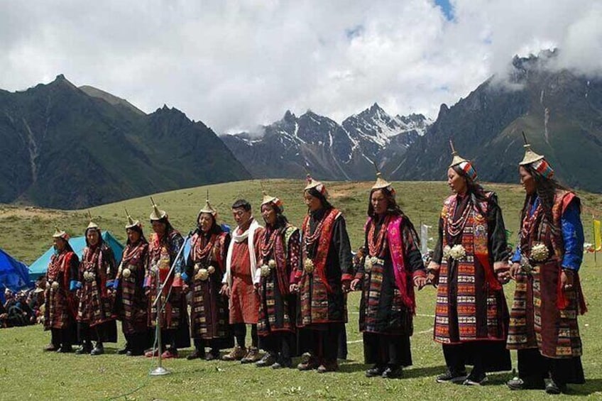
The people of Laya performing traditional dance at local festival
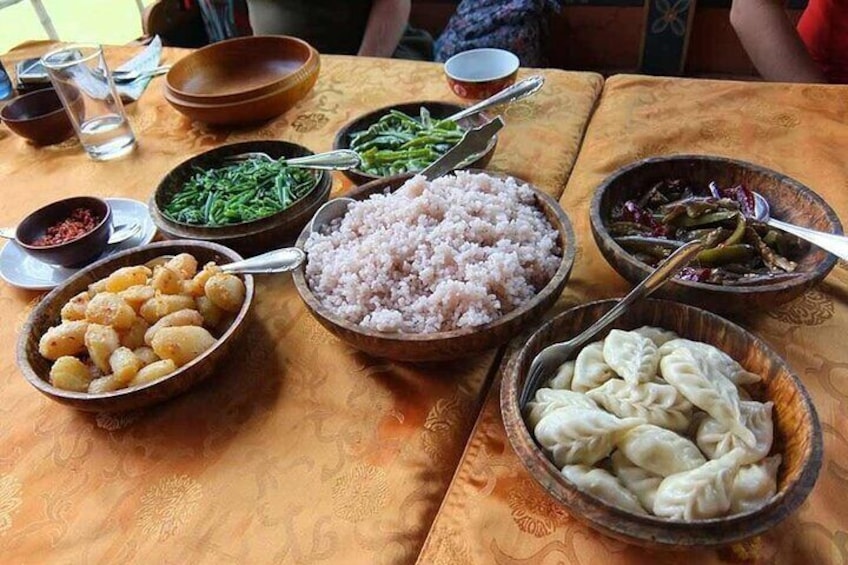
Home-cooked traditional cuisine
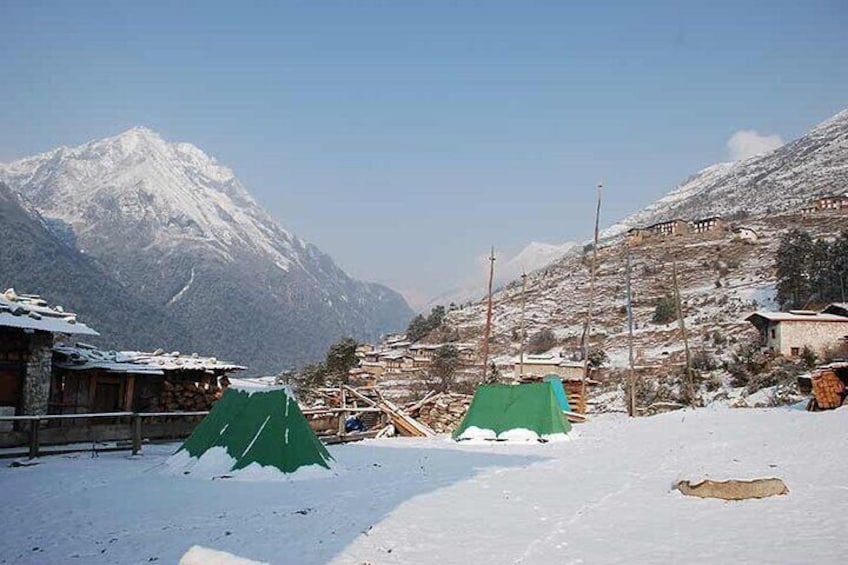
The village of Laya in November
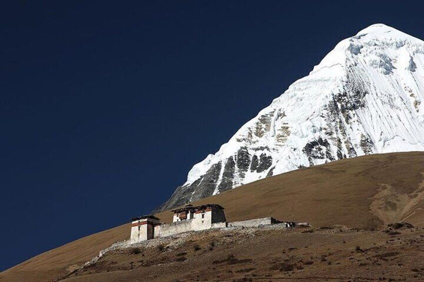
Lingzhi Dzong at 4150m asl
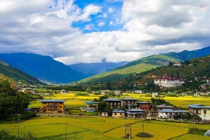
Rice fields in Paro valley, western Bhutan

17 Days Jomolhari Laya Gasa Trekking Adventure in Bhutan

By Bhutan Acorn Tours and Travel
Features
  • Mobile voucher
  • Instant confirmation
Overview

The Laya-Gasa Trek is considered one of the most scenic treks in Bhutan, offering amazing views of some of the most pristine and unspoiled landscapes in Bhutan. This 17-day, 217 km journey begins at Drukgyel in Paro and takes you through gorgeous alpine meadows, high mountain passes and dense sub-tropical jungles before terminating in Damji in Tashithang in the district of Gasa.

Along the trail, you’ll be able to spot indigenous animals such as blue sheep and Takins, the national animal of Bhutan. You’ll travel through remote mountain villages inhabited by Layaps (people of Laya), a distinct segment of the Bhutanese society with unique culture, traditions and appearance. The trek also offers a day of relaxation at the famous Gasa hot springs that is sure to rejuvenate you.

This is one of the more difficult treks offered in Bhutan due to high altitudes and steep ascents and descents. The best seasons to complete this challenge are in April-June and Mid-September to Mid-November.

Activity location

  • National Museum of Bhutan འབྲུག་གི་འགྲེམས་སྟོན་ཁང་།
    • Paro, Paro, Bhutan

Meeting/Redemption Point

  • National Museum of Bhutan འབྲུག་གི་འགྲེམས་སྟོན་ཁང་།
    • Paro, Paro, Bhutan

Check availability


Sorry this activity isn't available on Thu, 16 May
Please choose a different date

What's included, what's not

  • What's includedWhat's includedAll internal taxes for the services listed above
  • What's includedWhat's includedPorters & Ponies
  • What's includedWhat's includedAll meals (breakfast, lunch & dinner) and light snacks
  • What's includedWhat's includedSleeping bag liner (not sleeping bag)
  • What's includedWhat's includedExperienced English-speaking licensed tour guide
  • What's includedWhat's includedMedical treatment at a hospital in Bhutan if you sustain injuries while in Bhutan
  • What's includedWhat's includedAll ground transportation including round trip airport transfers
  • What's includedWhat's included12 nights full-service outdoor camping in pristine wilderness
  • What's includedWhat's included4 nights accommodations at a 3-star hotel on a twin sharing basis
  • What's includedWhat's includedEntry fee for National Museum and trekking permit
  • What's includedWhat's includedVisa Fee & Processing. You'll receive your e-Visa within 4-5 business days.
  • What's excludedWhat's excludedTravel insurance is mandatory
  • What's excludedWhat's excludedEmergency evacuation
  • What's excludedWhat's excludedInternational flights. Let us know if you need help with arranging flights to and from Bhutan
  • What's excludedWhat's excludedAlcoholic beverages, laundry services, telephone call charges
  • What's excludedWhat's excludedTips to Guide and Driver
  • What's excludedWhat's excludedSleeping bag & travel pillow (you need for camping during trekking)
  • What's excludedWhat's excludedGuide speaking other major languages can be arranged for an additional fee
  • What's excludedWhat's excludedAny other expenses of personal nature
  • What's excludedWhat's excludedAll Entry fees except for National Museum

Know before you book

  • Travelers should have a high level of physical fitness
  • A minimum of 3 participants are required to run this tour and can be run on a private basis.
  • We highly recommend booking at least a few months before the departure date so that we have enough time to ensure the flights are available. If you already have flight tickets to and from Bhutan, we can take bookings up to a week before the departure date. To process visa, it only takes 4-5 business days.
  • There are only two airlines that connect Bhutan with the outside world and so securing air tickets can be difficult, especially during the months of high season. Currently, Bhutan is connected with these cities - Bagdogra, Bangkok, Delhi, Dhaka, Guwahati, Kathmandu, Kolkata, Singapore. We recommend you book your international flights a few months in advance especially if you plan to visit during the high season months of March to May and September to November. If you need help in arranging flights to/from Bhutan, please let us know much in advance.
  • After you book the tour, kindly send us clear passports copies of all the participants. A biodata page including the machine-readable zone must be seen clearly. Passports should have a minimum of 6 MONTHS validity from the day you depart from Bhutan. You may also want to check the passport requirements by your next destination country after Bhutan. A copy of your e-Visa will be emailed to you once it is approved. It only takes 4-5 business days to get visa approval and it is 100 percent guaranteed as long as we receive clear passport copies of all the participants. The actual visa will be stamped on your passport upon arrival. Send the passport copies to the Local Supplier E-mail address.
  • Travelers should have a strong physical fitness level
  • Youth 18 years old MUST send us a copy of their valid Student Photo ID Card/Document to keep the discounted price. Without a copy of valid Student Photo ID Card/document, the full adult price will apply. Youth MUST also be accompanied by at least one full-paying adult .

Activity itinerary

Day 1: Arrive Paro International Airport & Sightseeing in Paro (2200m)
  • 1 stop
  • Meals: lunch, snacks
  • Accommodation: Dinner and overnight at Khangkhu Resort or Tenzingling Resort
National Museum of Bhutan འབྲུག་གི་འགྲེམས་སྟོན་ཁང་།
  • 2h
  • Admission ticket not included
Arrive at Paro International airport by either of only two airlines operating in and out of Bhutan; Drukair, the national flag carrier or Bhutan Airlines, a private airline that was started in 2011. You will be received by our guide and driver at the arrival hall and then transfer to the hotel. After checking in and settling yourself in the new surroundings, you will be taken on your first adventure into the ‘Kingdom of Thunder Dragon’. We will visit the National Museum of Bhutan, to get a glimpse of the history and rich cultural traditions of Bhutan. Located below the National Museum is the 17th-century Paro Rinpung Dzong which serves as the office of the Paro District Governor and residence of the district clergy. From there drive to visit Sangchoekhor Monastery located on a hilltop overlooking the Paro valley. You'll have an opportunity to meet the monks and offer prayers at the serene monastery. Leisure time around Paro town.
Day 2: Full Day Acclimatization - Hike to Taktsang Monastery, Tiger's Nest (3120m)
  • 1 stop
  • Meals: breakfast, lunch, snacks
  • Accommodation: Dinner and overnight at Khangkhu Resort or Tenzingling Resort
Paro Taktsang
  • 5h
  • Admission ticket not included
After breakfast, drive to Ramthangka, the base of the Taktsang monastery. Taktsang monastery is built on the face of an 800-meter rock cliff in Paro. The hiking normally takes about 4-5 hours round trip. The trail takes you through the ancient path shaded by pine trees. After an hour of steep uphill hiking, you will reach a nice cafeteria from where you can see spectacular views of Taktsang monastery perched on the face of a steep rock cliff and beautiful valley below. Hot tea and snacks will be served here. From this viewpoint, it takes a further 1 hour to reach the monastery, receive blessings from many sacred relics and artifacts and enjoy grand views of the Paro valley below. After lunch at the cafeteria, we retrace our steps back to the base where our driver will be waiting. Leisure time in Paro town.
Day 3: Trek Begins] Paro Drukgyal Dzong / Shana Zampa (2850m)
  • 1 stop
  • Meals: breakfast, lunch, snacks
  • Accommodation: Full-service overnight outdoor camping at Shana
Shana
  • 3h
  • Admission ticket included
After leisurely breakfast, visi an auspicious 7th-century Kyichu Lhakhang and pray for the journey ahead. Paro Kyichu Lhakhang was built on a single day in 659AD by the Tibetan King Songtsen Gampo as part of his mission to subdue an evil spirit that was obstructing the propagation of Buddhism across the Himalayan region. We then drive to Shana Zampa in Gunitsawa Village, the starting point of the trek via Drukgyal Dzong. If interested, spend about 30mins visiting the Drukgyal Dzong, a 17th-century fortress that is undergoing complete renovation since 2016 and is expected to bring back to its former glory very soon. After about an hour of drive, you will reach the village of Gunitsawa passing through an army check post where your trekking permit will be checked and endorsed. The campsite is on the opposite side of the river, not far from the army check post. Distance 33km | Time 1.5-hour drive | Camp Altitude 2,850m/9,350ft
Day 4: Shana Zampa / Thang Thanka (3610m)
  • 1 stop
  • Meals: breakfast, lunch, snacks
  • Accommodation: Full-service overnight outdoor camping at Thang Thangka
Thang Thangka Camp
  • 7h
  • Admission ticket included
On this long day, the trail continues with lots of small ups and downs. After going uphill through the river valley the valley finally narrows gradually to a mere path that descends to a meadow where a camp will be set up. From here, if weather permits, you will have the first great view of Mt. Jomolhari. Distance 22km | Time 7-8 hours | Ascent 770m/2,526ft | Descent 10m/33ft |Camp Altitude 3,610m/11,845ft
Day 5: Thang Thanka / Jangothang, Jomolhari Basecamp (4080m)
  • 1 stop
  • Meals: breakfast, lunch, snacks
  • Accommodation: Full-service overnight outdoor camping at the base of Mt. Jomolhari, Jangothang
Jomolhari Base Camp
  • 6h
  • Admission ticket included
If you did not see Mt. Jomolhari the previous evening, you will still have a chance to get a great view early this morning. This morning the trek continues up the Paro Chhu valley which widens into patches of alpine meadow and scanty growths of forest. You will cross an army checkpoint along the way and enjoy a spectacular view of high mountain ridges and snow-capped peaks. In this area yaks and their herder’s homes become a regular feature of the landscape. Passing the villages Soe, Takethang and Dangochang is another asset on this day. After reaching Jangothang, one of the most beautiful campsites of the Himalayas, you will again have a spectacular view of Mount Jomolhari. Distance 19km | Time 6-7 hours | Ascent 480m/1,575ft | Camp Altitude 4,080m/13,385ft
Day 6: Halt at Jangothang & Explore the Pristine Area (4080-4500m)
  • 1 stop
  • Meals: breakfast, lunch, snacks
  • Accommodation: Full-service overnight outdoor camping at the base of Mt. Jomolhari, Jangothang
Jomolhari Base Camp
  • 7h
  • Admission ticket included
The rest day in Jangothang provides plenty of possibilities for day hikes with great views of lakes and snow-capped mountains such as Jomolhari and Jichu Drake. There are good chances to spot some blue sheep on the upper slopes of the valley. Jangothang is a perfect environment for your acclimatization. You can also trek up to Tosoh or hike around the area. There are good short hiking trails in three directions. Jomolhari and its subsidiary mountain chains lie directly west, Jichu Drake to the north and there are a number of unclimbed peaks to the east.
Day 7: Jangothang / Lingzhi (4010m)
  • 1 stop
  • Meals: breakfast, lunch, snacks
  • Accommodation: Full-service outdoor camping at Lingzhi
Lingzhi
  • 7h
This is one of the longest days of the trek. A short distance from the camp the trail begins climbing rapidly for about half an hour and then becomes a gradual ascent to the Nyilila pass at 4,870m. While on the climb enjoy the surroundings. You might see herds of blue sheep grazing on the slopes of the mountains. From the pass you will have spectacular views of Mt. Jomolhari, Jichu Drake and Tsherimgang, all of them rising above 7,000m. It’s a gradual descent to the camp where you will pass by some of the yak herder’s tents, made from yak wool. The herders use these tents while travelling to various pastures for their yaks. As you come down into the Lingshi basin, a beautiful U-shaped valley, you get a wonderful view of Lingzhi Dzong on clear days. Tserimgang and its glaciers rise up at the north end of the valley. The campsite is next to a stone hut just before Lingzhi Dzong. Distance 18km | Time 6-7 hours| Ascent 840m/2,755ft | Descent 870m/2,855ft | Camp Altitude 4,010m/13,156ft
Day 8: Lingzhi / Chebisa (3880m)
  • 1 stop
  • Meals: breakfast, lunch, snacks
  • Accommodation: Full-service outdoor camping at Chebisa
Chebisa
  • 5h
Today is the shortest walking day, and you can really take it easy. Shortly after starting you will reach a chorten below Lingshi Dzong. Here, you have the choice of staying on the main trail or taking a detour up to the Lingshi Dzong (4,220m), which sits right atop a high ridge. The Dzong is under reconstruction after it was damaged by a 2011 earthquake. In addition to a very special atmosphere of mystic tranquility, Lingshi Dzong provides a great view over the valley. After Lingshi Dzong you will be passing the villages of Lingshi and Goyul. In Goyul, the stone houses are clustered together to form a small compact village that is unusual in Bhutan where settlements are usually scattered. On reaching the campsite at Chebisa you will have plenty of time to visit the village houses. There is also a beautiful waterfall located behind the village that is worth visiting. Distance 10km | Time 5-6 hours | Ascent 280m/918ft | Descent 410m/1,345ft | Camp Altitude 3,880m/12,730ft
Day 9: Chebisa / Shomuthang (4220m)
  • 1 stop
  • Meals: breakfast, lunch, snacks
  • Accommodation: Full-service outdoor camping at Shomuthang
Chebisa
  • 6h
The morning starts with a long ascent behind Chebisa Village (2-3 hours) through a wide pastureland towards Gobu La (pass). On the way, you will see a few people herding yaks. There is also a great chance to spot large herds of blue sheep above the trail. After crossing Gobu La (4,410m), you descend into the valley, then climb again a little bit, before descending again to Shakshepasa (3,980), a large U-shaped valley. Climbing from here you will finally reach the campsite at Shomuthang, above a river, which is a tributary of the Nochu river. Distance 17km | Time 6-7 hours | Ascent 890m/2,920ft | Descent 540m/1,771ft | Camp Altitude 4,220m/13,845ft
Day 10: Shomuthang / Robluthang (4160m)
  • 1 stop
  • Meals: breakfast, lunch, snacks
  • Accommodation: Full-service outdoor camping at Robluthang
Laya
  • 7h
You begin by climbing up the valley to view Kang Bum (6,526 m) and some edelweiss. After two hours of climbing you will reach Jhari La (4,750m), from where you catch the first glimpse of Sinche La, the pass you will have to cross the day after. The big snow peak in the north is Gangchhenta 6,840 m, better known as the Great Tiger Mountain. If the weather is clear, Tserim Kang and the top of Jomolhari will be visible. The camp by the river is called Tsheri Jathang located in a beautiful wide and remote valley. Herds of takin, the Bhutanese National Animal, migrate to this valley in summer and remain for about four months. The valley has been declared a takin sanctuary. Climb up a little bit and you will reach the campsite at Robluthang in a rocky meadow. Distance 18km | Time 7-8 hours | Ascent 700m/2,296ft | Descent 760m/2,493ft | Camp Altitude 4,160m/13,648ft
Day 11: Robluthang / Limithang (4140m)
  • 1 stop
  • Meals: breakfast, lunch, snacks
  • Accommodation: Full-service outdoor camping at Limithang
Laya
  • 7h
The trek starts out with an initial 40-60mins ascent before gradually raising for another 1.5 hours through a boulder field. It is then a 1-hour steep ascent before reaching Sinche La (5,005m) – the final and highest pass on the trek if you don’t intend to continue the Snowman trek from Laya onwards. As you descend the far side of the pass you will see an impressive terminal moraine and a glacial lake at the foot of the valley. You can see classic examples of lateral moraines where the glacier has pushed rocks up both sides of the valley. Below the moraine, you cross the Kango Chhu and soon reach the Limithang campsite. The peak of Gangchhenta towers over the campsite even though it’s quite a distance away. Distance 19km | Time 7-8 hours | Ascent 850m/2,788ft | Descent 870m/2,854ft | Camp Altitude 4,140m/13,582ft
Day 12: Limithang / Laya Village (3840m)
  • 1 stop
  • Meals: breakfast, lunch, snacks
  • Accommodation: Full-service outdoor camping at Laya village
Laya
  • 5h
Today, you walk downhill all the way along a narrow, winding river valley. After a long time, the trail takes you through a densely forested region. The trail leads you to the west side of Laya village. From the west of the village, you will have spectacular views of Mt. Gangchhenta (Tiger Mountain) and catch Mt. Masagang. In the village centre is a community school and a basic health unit with a telephone connection. The campsite is located below the school. Distance 10km | Time 4-5 hours| Ascent 60m/196ft | Descent 640m/2,100ft | Camp Altitude 3,840m/12,598ft
Day 13: Laya / Koina (3050m)
  • 1 stop
  • Meals: breakfast, lunch, snacks
  • Accommodation: Full-service outdoor camping at Koina
Koina Mountain Lodge
  • 7h
  • Admission ticket included
The trail winds up and down along the river valley of Mo Chhu avoiding natural obstacles and affording breath-taking views of the raging river, feeder streams and waterfalls. Lots of ups and downs will lead you to Kohi Lapcha at 3.300 m. The trek then drops down to the large stream of Koina Chhu, where you will find the campsite of Koina. Distance 19km | Time 7-8 hours | Ascent 260m/853ft | Descent 1,070m/3,510ft | Camp Altitude 3,050m/10,006ft
Day 14: Koina / Gasa (2850m)
  • 1 stop
  • Meals: breakfast, lunch, snacks
  • Accommodation: Full-service outdoor camping at Gasa
Gasa
  • 6h
Today you will have the last major climb of the Laya Gasa Trek. You will cross Bari La (3,740m), after which the trail descends all the way until you reach Gasa village (2,770m), where you will find the first restaurants since you started from Drukgyel Dzong. There also is a campsite close to Gasa Dzong. You will have to decide whether you want to stay in Gasa village or descend for another hour to the Gasa Tsachu (hot springs) and relax in the rejuvenating mineral waters. The Gasa Tsachu is one of the most popular hot springs in Bhutan. Distance 14km | Time 6-7 hours | Ascent 740m/2,427ft | Descent 1,500m/4,921ft | Camp Altitude 2,850m/9,350ft
Day 15: Gasa / Punakha Valley (1200m)
  • 1 stop
  • Meals: breakfast, lunch, snacks
  • Accommodation: Overnight at Meri Puensum Resort or Zhingkham Resort.
Punakha
  • 4h
Today, you will spend the morning leisurely soaking up in the hot spring and after lunch, transfer to Punakha valley for an overnight stay. Distance 95km | Time 3.5-hours | Punakha Altitude 1,200m/3,937ft
Day 16: Punakha / Capital City Thimphu (2334m)
  • 1 stop
  • Meals: breakfast, lunch, snacks
  • Accommodation: Dinner and overnight at Kuenphen Rabten Resort or Hotel Amodhara.
Thimphu
  • 3h
After breakfast, visit the 17th-century historic Punakha Dzong considered as the masterpiece of Bhutanese architecture and walk to Bhutan’s longest suspension bridge that stretches across glacial-fed Phochu (male) river. We then drive to Chimi Lhakhang (Temple of Fertility) popularly known among tourists as “Temple of Fertility”. A gentle walk through the terraced rice fields and traditional farmhouses painted with phalluses will give you a unique experience. Explore the nearby village. After lunch, transfer to Thimphu via the sacred Dochula Pass. Stop briefly at Dochula, a sacred mountain pass at an elevation of 3150m and enjoy a grand view of some of the highest mountains of Bhutan on a clear day. From there continue driving towards Thimphu and gradually descend to the capital city of Bhutan. Arriving in Thimphu, visit Buddha Dordhenma Statue located on a hilltop overlooking the Thimphu valley. Distance 74km | Time 2.5-hours | Thimphu Altitude 2,334m/7,655ft
Day 17: Transfer to Paro International Airport for Departure
  • 1 stop
  • Meals: breakfast
  • Accommodation: Not included
Paro International Airport
  • 1h 30m
After breakfast, drive to Paro and transfer to Paro International Airport for your onward journey. Your guide will assist you to complete all exit formalities before you check in. Distance 55km | Time 1 hour | Paro Altitude 2,195m/7,200ft

Location

Activity location

  • LOB_ACTIVITIESLOB_ACTIVITIESNational Museum of Bhutan འབྲུག་གི་འགྲེམས་སྟོན་ཁང་།
    • Paro, Paro, Bhutan

Meeting/Redemption Point

  • PEOPLEPEOPLENational Museum of Bhutan འབྲུག་གི་འགྲེམས་སྟོན་ཁང་།
    • Paro, Paro, Bhutan

Best Deals on Things to Do

Experience the wonders of the world up close with great deals on things to do near and far. Expedia offers one-of-a-kind activities that allow you to explore Paro your way. Whether you love nature, culture, food or a bit of adventure, we have the perfect activity for you.

Top experiences in Paro

With so many things to do in Paro, planning the perfect day out may seem like a daunting task. Expedia is here to take the hassle out of finding the best attractions, tours and activities in Paro. Families, couples and business travellers can all find the perfect activity in Paro to create life-long memories with the help of Expedia.